For almost two weeks, I had been heading south. Of course, this was a good thing given that I’m aiming to make it to Argentina in December. But, as the age-old adage goes, ‘sometimes you need to go backwards, in order to go forwards’.
After arriving in San Agustin, deep in the south of Colombia’s Huila department, I needed to make a navigational decision. From the mountain town I was in, there were a number of different routes between me and the Ecuadorian border; my next major objective. I could continue on my due-south trajectory, through the town of Mocoa, crossing the border at San Miguel. Alternatively, I could point my front wheel north-east for a few days to reach the city of Popayán in the adjacent department of Cauca. From there, it would be a run south to the town of Ipiales. This is the busiest border crossing as it is where the Panamerica Highway enters Ecuador as it makes its way from Alaska to Argentina.
While I toyed with each option, I received a message from one of my best mates back home, Charlotte. She had stayed in Mocoa for a while when she was in Colombia a few years back. Her description of the region was alluring. Mocoa sits on the border of the rainforest and is supposedly surrounded by crystal clear waterfalls and vibrant, exotic flora. Char had also crossed the border at San Miguel, and despite the changes Colombia has undergone recently, her account of sandbags and AK47s wasn’t exactly selling the less travelled route. On a side note, I expressed to Char that I was struggling with rest days. The movement of the bike gives me a daily purpose and an autonomy that feels so empowering. When I stop, I struggle to do just that; stop. She suggested long lunches, listening to conversations to practice my Spanish, or to simply ‘do what the old men do’. Learning to just exist and ‘be’ is something that I’m working on while on the road.
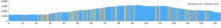
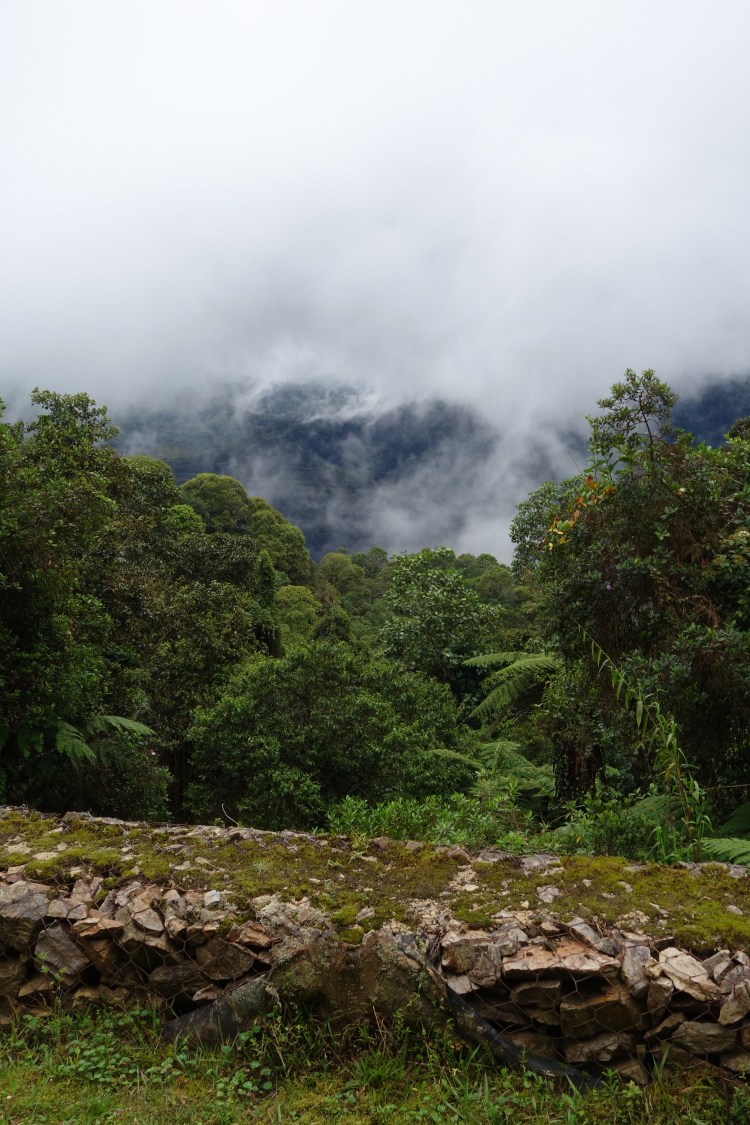
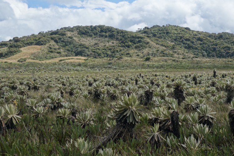
My other option, the road to Popayán, would involve a more elevated route. But, there was something about this line on the map that captivated me. As the road rolls over the top of Cordillera Central, it passes through the páramo; one of the world’s most important ecosystems. Páramo is the name given to the ecosystem between the tree line and the permanent snow line and is also considered the fastest evolving ecosystem on Earth. Fascinatingly, Colombia is one of only three countries in the world where the páramo is found, and is home to more than 60% of these crucial moorlands. Amongst the wealth of endemic plants and animals that are found in the páramo, it’s signature species is the Frailejon; a sunflower like plant, growing one centimetre a year, yet standing tall above the other sub alpine species. The Frailejon is renowned amongst biologists for its ability to capture water from low hanging clouds and release it back into the soil. It is the process which cities such as Bogota can thank for their continuous water supply, hence its representation on one of Colombia’s coins. Whilst there are a number of sites to view the páramo around Colombia and the northern Andes, the road to Popayán passes through Purace National Park. It is the páramo within Purace that gives birth to several of Colombia’s major rivers, including the Magdalena. Having more or less followed this water source for over a week, it felt right to ride through the ecosystem where it all begins.
So, I headed in the opposite direction from Argentina via the road to Popayán. In my description of the páramo I’ve failed to mention that this road also came with many warnings from locals as being slow, rocky, full of potholes, freezing cold, and always raining. But, the páramo, man.
As I rode up into the clouds, having to stop and put my leg warmers on for the first time, Char’s description of the rainforest and waterfalls began to sound divine.
Mysteries in History
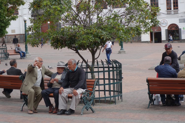
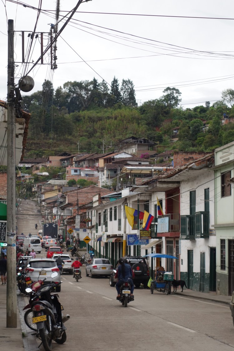
Aesthetically, the town of San Agustin leaves much to be desired. It lacks the colour and vibrancy of the other Colombian settlements I have pedalled through. Looking across the rooftops of the city it is often difficult to tell where the grey concrete buildings finish and where the low hanging clouds begin. Despite some brilliant coffee shops, San Agustin isn’t a place where you would happily spend days wandering the streets. But, this doesn’t matter in the slightest as the streets are abuzz with tourists and the anticipation of what lies in the surrounding hills.

Over 6000 years ago, people began to reside in the area due to a wealth of natural resources. Fast forward several generations and people are still flocking to the region to wander amongst the mysterious relics of the various groups that once called this region ‘home’.
San Agustin is located in the Colombian Massif, where several societies are known to have developed different ways of thinking about, inhabiting and working with their natural surroundings. The mountainous landscape is Colombia’s most significant source of water. Within the catchment, the various watersheds, high mountain lakes (of which there are 362) and countless tributaries give birth to five of Colombia’s major rivers, all crossing the country in different directions. The Patia River runs to the west and out into the Pacific Ocean; The Magdalena and Cauca Rivers forge a path to the north towards the Caribbean coast; and, the Putumaya and Caqueta Rivers traverse the territory towards the Eastern Amazon. Due to this phenomenon, the Colombian Massif is poetically referred to as the Colombian Fluvial Star.

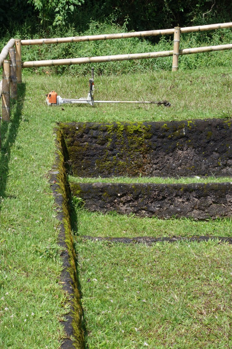
Constantly subject to heavy rains, it is this landscape of deep gorges, swollen rivers and thick vegetation, that dictated the life of those who made a home in the region. Survival relied on the ability to develop efficient strategies for making good use of the surrounding resources, as well as constant experimentation, adaptation and transformation over time. Archeologists have discovered terraces which indicate farming and settlement on the steep banks that descend into the deep river valleys. They have also identified elaborate drainage systems for optimising agricultural productive, as well as road networks and raised embankments.
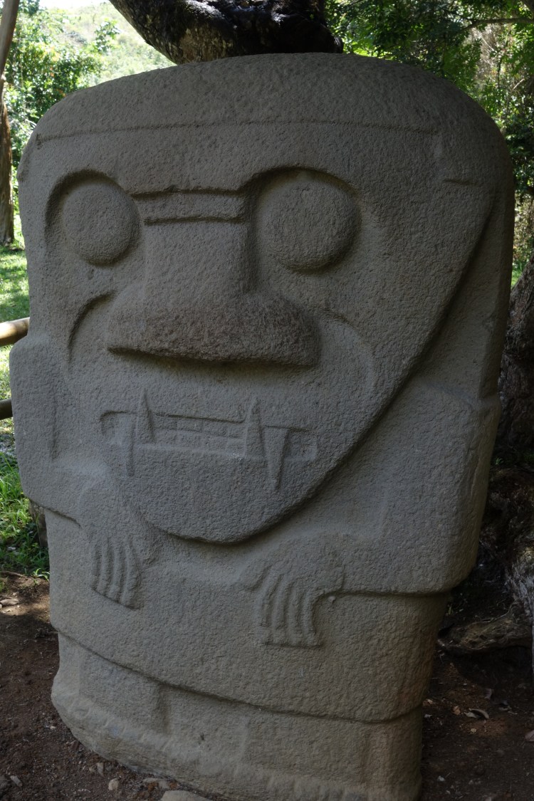
In addition to the evidence pointing to the established lives of people in the region, it is the honouring of the dead that has provided the most interest, and mystery, for archeologists exploring the Colombian Massif. The various groups that lived within the region left large burial mounds at a number of sites. Buried within these mounds of earth, up to four meters in height, were tombs, composed of slabs of volcanic rock, statues and stone sarcophagi. The distribution of these monumental tombs, built to contain the bodies of important people with great spiritual or political power, is thought to follow a particular order, dictated by the axis, topography and life forms of the Magdalena River.
Carbon dating has identified that these burial mounds were constructed around 2000 years ago. The elaborate funerary structures that adorn these sites are said to have been guarded by deities and other wondrous creatures. Any archeological work that occurred involved an enormous effort. In addition to the time spent traversing the landscape, it took great ingenuity, and whatever makeshift technology was available at the time, to move these monumental statues. Once the statues were fully observable, the following challenge was to interpret and reconstruct all archeological contexts. This is something that is still be debated amongst academics and visitors to the region, as they continue to struggle with the following questions: where did the carvers of the statues come from and to where did they expand? How did such a great civilisation come to settle in Colombia and how did it disappear? Why did these cultures devote so much time and labour to building tombs and statues for their dead? And, what significance did monumental art carry for these ancient settlers?

As a visitor to the San Agustin area, there is a designated site for viewing a number of the burial tombs and most well preserved monuments. This is known as the San Agustin Archaeological Park, which, in 1995, was named a UNESCO World Heritage site. Once you have purchased your ‘passport’, you have two days of unlimited access to various locations throughout the site, which is simply an enormous outdoor museum, containing over 500 statues.
Wandering amongst the various monuments which are nestled between dense stands of bamboo, it is hard not to develop your own theories for the questions that still baffle the experts. Various interpretations over time have identified the sculptures as gods, devilish images, men in trance, and even creatures serving as bridges between the world of men and that of animals. But, the jury is still out, which makes time spent in the park even more mysterious.
I spent most of the day in the park, wandering between sights, reading in the shade, disappointing stray dogs with my lack of food, and relishing the cooler temperatures. That morning, I’d walked the three kilometres from the centre of town to the Archaelogical Park, getting caught in torrential rain and seeking token shelter from the roadside tree canopy. I’d since dried out so decided to take a local bus back to town. Interestingly, when it is raining, beneath the canopy is the driest space. But, in between rain showers, the residual water caught amongst the leaves is shaken to the ground, falling like rain.
Back at the hostel, I was in the midst of route planning for the next day, when another cyclist walked into the common area. Travelling by bike is conversational currency, especially with anther cyclist. He introduced himself as Paolo. I was struck by his enthusiasm and the way he listened so intently with unbreakable eye contact. After telling him of the route now behind me, and my plans for the next few months, he began explaining what he was doing in San Agustin. It turned out that he was half way through a lap of the country, beginning and ending in his hometown in the north, Pereira. Most importantly, he was doing so to raise awareness about the conservation of Colombia’s unique ecosystems and the animals within them, specifically, the tapir. If you haven’t seen a tapir then you should have a look on Google. Weighing up to 200kg, they are a large, black, pig-like animal with a stumpy trunk. The majority of tapir that have been identified throughout the world are listed as vulnerable or endangered, hence Paolo’s mission.
After sharing the bare details of our respective rides, Paolo paused.
“Tomorrow you will ride the road to Popayan, no?”
As I nodded in agreement, I could see the cogs turning in Paolo’s mind. From what I had read, this road had a 40km stretch of potholed, rough and, depending on the rain, muddy riding. Paolo was on a conventional road bike with much narrow tires than my all terrain ride.
“I spoke to someone today who has seen a tapir along that road, up on the páramo. I think I will join you”, he stated with confidence. It was clear that he had weighed up his options. It was a rough ride and a possible tapir, or no tapir at all. I don’t think it was a hard decision. We agreed that we’d leave in the morning. I felt good about having company on the road and the idea of exploring such a unique ecosystem with a man as passionate as Paolo was exciting.
After a day exploring the ancient monuments of San Agustin, we bid each other good night. The idea of possibly seeing one of Colombia’s living mysteries was the perfect motivation for the road ahead.
Yeferson and Honey
I woke to music penetrating through the single sheet of plywood from Paolo’s room next door. It was intense psy-trance; 10 minute tracks punctuated by intergalactic tones and Paolo’s slightly off harmonies. Regardless, I took it as a sign that he was getting in the zone for the dubious road ahead.
After stuffing my panniers, I nipped down the street to a two-story bakery on the corner of a busy intersection. The second floor’s small wooden window frames with peeling forest-green paint provided the perfect porthole from which to watch the town wake up. The bakery had treated me well several times over the last 48 hours so I figured I had time to squeeze in one last sweet black coffee and a French-influenced pastry (or three).
I scooted back to the the hotel, jumping between the shelter of umbrellas as a persistent drizzle had engulfed the town over the course of breakfast. As I clipped my panniers to the racks on my bike, a wet and distressed Paolo pushed through the front door. He was wearing the outfit he’d been in since I met him; running shorts the length of $5 note, a fluorescent-blue tank top, and lime-green, calf compression tights. He cut an athletic figure in this superhero outfit which suited his passionate and energetic persona perfectly. I asked if he was ready to hit the road.
“Andy, no. I will wait for tomorrow. I was out running and a dog was hit by a motorbike. It needs me to stay here. I will pay for the medical help and make sure it’s ok.”
I couldn’t argue with him. He practiced what he preached to the nth-degree. Whether riding 1000km to raise awareness for an endangered species, or seeing to the health of a stray dog involved in a traffic accident, this guy had purpose. I liked Paolo and would have relished in a few days spent riding in his company. Alas, we parted ways and I left him with a poorly animal that definitely needed his companionship more that I did. He chased me down the road with his GoPro as I pedalled out of town.

Immediately, the road fell away from the mountain town as I backtracked several kilometers to the turnoff for Popayán. The rain over the last few days had breathed life into the waterfalls that now gushed over the ridgelines, plunging into the rivers below. At the intersection, I joined a hoard of poncho-wearing local motorcyclists and a small group of backpackers as we all sought shelter at a small roadside stall. The rain was lashing down as we huddled in under the tin roof waiting for the clouds to part and for their bus to arrive. Despite the rain still falling lightly, I figured it was clearing as the motorcyclists fired up their engines and even the resident stray dog wandered back out and recommenced tearing a bag of rubbish apart in the hopes of feed.
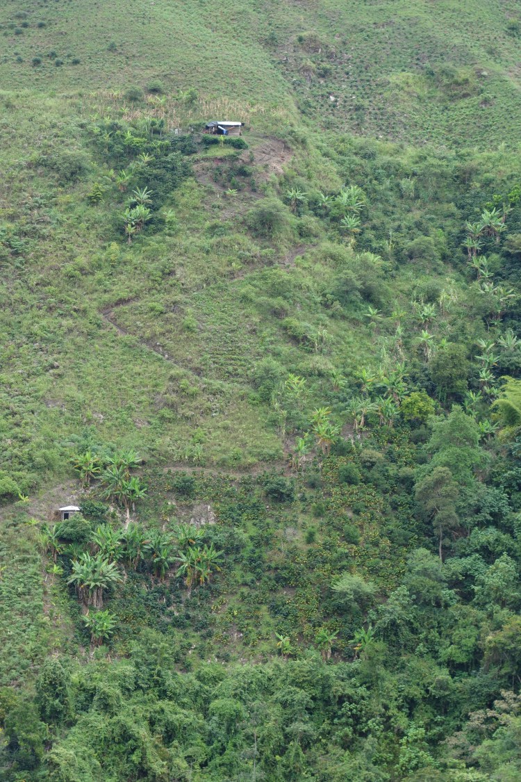
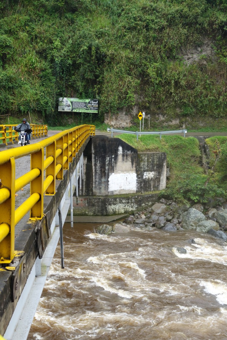
I rode away from the intersection and my lowest point for the day (in elevation). I crossed the Magdalena which was now swollen and churning as it drank up the excess water falling from the hills. I settled into the climb averaging around 12km/h as the valley floor opened up beneath me. The hillsides appear like a patchwork quilt of various crops at different stages of succession. The square plots of different shades of green and brown are stitched together by the steep, switchbacking trails that weave between them.
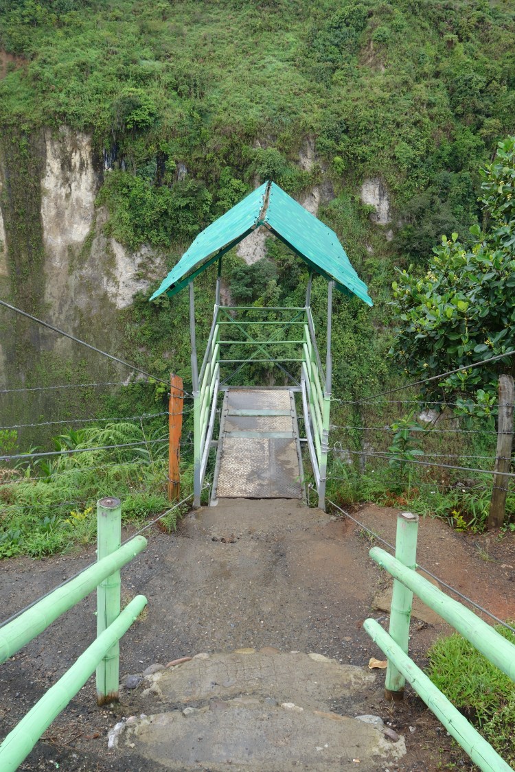
Following signs and a rough dirt road, I took a detour to visit Salto El Mortino. I expected a waterfall, but to what extent, well, I still had my head in the clouds. The short road terminated at a café, adorned with piles of neatly arranged fresh fruit. Most impressive, however, was the fact that the café sat precariously atop a cliff overlooking the deep gorge below. The waterfall, fell from the same height as the café to the misty depths of the gorge. With caution, I slowly placed one foot, then the other, on the makeshift, cantilevered viewing platform that extended out a few meters above the gorge. Eighty-percent sure that it would hold me, I took a few steps out and marvelled at the force of the water that had carved its way through weaknesses in the volcanic rock below me. I thanked the platform for its support during my visit and got back on the road, but not without sampling one of the most succulent pieces of pineapple I have ever tasted from the café at the top of the falls.

As the road continued upwards, I was guided between increasingly dense coffee plantations and crops of maize. Despite passing traffic, there was little sign of people around. However, when the cars had passed and the road was silent, I could hear laughter and crackling salsa from portable radios rising out of the fields.
In researching this route, all of the online reviews and comments had been from drivers. Navigating potholes with four wheels takes twice as much brainpower as guiding a thin line of two wheels between the obstacles. I was optimistic that it would be an easier ride than the online keyboard cowboys had made it out to be. In saying this, I expected around 50km of unsealed road over the next few days.
The first round of flooded potholes was only 5km. Yes, it was slow, slightly uncomfortable, and disruptive of any momentum I could carry forward. However, it was somewhat alluring. The pock-marked road disappeared into the mist before me and every now and then the clouds to either side would crack, showing just how high I was above the valley floor.
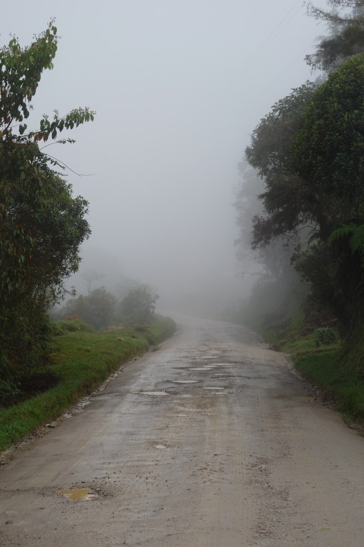
It was 3pm by the time I arrived at a small restaurant and a military checkpoint, where the infamous stretch of rough road commenced. I slurped down a bowl of broth, followed by a plate of flavourless, yet sustaining, beans and rice. I sat and stared out into the mist as the waitress’ indecisiveness as to what song to play over the enormous sound system, eroded my patience. I was still optimistic of the road ahead. It was cool, but not cold. And, it was far from ‘freezing’ as the unacclimatised truck drivers from the hot lowlands attested to it being up on the páramo. I still had my leg warmers on, but this was more to keep my knee warm. My left knee has been giving me some slight grief. I was told by a physio before I left that it is a slight patella tracking issue and that I need to strengthen my week arse. It would appear that spending my days inside at a desk for the last four years has weakened the muscles that keep my knees aligned. Oh, the joys. I had been strapping it for a few days but as the afternoons heated up and my perspiration increased, the tape would peel away. I had been riding into towns with strapping tape flapping from my knee, feeling like Forest Gump running free of his stirrups.
Anyway, my knee had been feeling good on the climb so I decided to push on for the afternoon. At the military checkpoint I was surrounded by four young soldiers, guns hanging from their shoulders and cigarillos from their lips. When they spoke, they all had gold teeth. Despite the Bond-villain facades, they were very hospitable. With laughter and arms around my shoulders, they expressed that I was ‘loco’. They assured me that there would be ‘cero casas’ and ‘muchos agua’ for the next 40km. And, yes, apparently it would be freezing! I pointed to my panniers expressing that I would be fine camping and rode away from their laughter. By this stage it was 4.30pm, and with the heavy mist that had set in, I anticipated darkness might arrive earlier than usual. I planned to begin looking for a camp at 5.30pm. Despite the fairly atrocious condition of the road (understandable given the amount of water in these hills), I was struck by how many cars, large trucks, and motorbikes passed me. We were all seeking the same code and sequence to get through the maze of corrugations and washouts in the smoothest way possible. The roadside vegetation was impenetrable, let alone flat and tent-friendly, and the twilight rains had well and truly settled in. I kept pedalling towards my evening deadline.
Just before 5.30pm, I was overtaken by a truck. I use the word ‘overtaken’ lightly. It was more a changing of the guard, as I continued to tail the truck for the next 15 minutes, both of us navigating the road at the same pace. I was in the zone and happy for the company despite the exhaust pouring out into my path. Suddenly, the truck’s brake lights lit up the dusk as it came to a staggering stop.
A lanky black man (black Colombians only make up 5% of the current population) jumped out of the cab wearing a sky blue polo, jeans and a smile almost too big for his face. Most striking of all was his laugh. Looking at my bike, he held his hands to the sky as if I hadn’t realised it was raining, before throwing his head back in a fit of pulsating, booming laughter. It was infectious. Of all the immunisations I’d had, I was still susceptible to his laughter catching on.
He offered me a lift. I declined. This was a cycling trip. I got myself into this situation. I was going to camp and emerge at the end of the road under my own steam. It would be fine.
He persisted.
Without the sufficient Spanish to truly explain my rationale, I looked up the road and into the encroaching darkness. To add to the equation, I was still yet to see a single possibility for even a below-average campsite. In a moment of silence, I questioned what completing the next 30km of this road would really prove (more on that later). I helped him tie my bike and panniers into the back of the truck, which was covered in faded khaki canvas and completely open at the back.
I stood at the passenger side door while he pushed aside a pile of clothes, blankets and bags of fresh pineapples and mandarins to make room for me in the cab. I climbed up to join him. He enthusiastically lent over, with hand extended, and introduced himself as Yeferson.
“And…”, he said digging into the pile of blankets between us, “this is Honey”, pulling out and handing me his chihuahua.
We both laughed – a theme that would ensue for the next four hours – before continuing up the bewildering road to Popayán.
Both the rain and the darkness came on strong. The lack of campsites that I was seeing made me feel much happier about my decision to take the lift. Yeferson’s English rivalled my Spanish vocabulary. Before we completely lost daylight, our conversations were based on the extent of words in my already tattered phrase book. At one point, he even pulled up in the middle of the road and took the book from my hands and spent the next five minutes with his nose in the Spanish to English dictionary. He then tuned to look at me, straight-faced, and proceeded to say “I. Almost. Already. Learn. English”.
His face cracked into his massive smile as he bent over the steering wheel in laughter, which I came to think resembled a baritone police siren. Whenever there was a lull in attempted conversation, he’d plug his phone into the truck speakers (via a certainly homemade adaptor that would spark sporadically) and crank the salsa. The rhythm flowed out of him, emphasising just how much a central part of life it is in his home town of Cali. It was a rarity, but whenever the needle on the speedo hit 10km/h, he would begin singing, always staying one word ahead of the track to prove how well he knew the song. He would look at me and optimistically count me into the choruses, as though I’d know what to sing. I couldn’t leave him hanging, so would resort to air-drumming, channeling the Phil Collins gorilla in the Cadbury ad, just with a little more Latino flare.
From what I could interpret, Yeferson was also a teacher, albeit of a class of 29 four and five year olds. I could tell from the way he lent back behind his seat, taking his eyes of the road to search for a picture of his class, that they meant the world to him. I couldn’t quite decipher why, as a primary school teacher, he’d been on Ecuador, in a truck, mid-week? Regardless, he was on his way home to Cali with pineapples for his elderly parents which made him seem like a pretty solid fella.
As the kilometres rolled past, arguably slower than if I was on my bike, I became awestruck by the amount of very large trucks using this route. On countless occasions, we would have two wheels in the gutters, which were gushing with water pouring out of the páramo. Yeferson would reach out the window to tuck in the side mirror and I would hold my breath. We only scraped canvases a few times. If the pace wasn’t slow enough we stopped several times as Yeferson was intent on checking on my bike. Although, I think it was just a manly excuse so that he could make sure Honey was wrapped sufficiently in her blanket. Even though Yeferson said he thought he was buying a mouse when he paid for her as a puppy, she did seem to be the perfect, low-maintenance companion for the road. I just couldn’t help thinking of how defenceless she would be outside the safety of the truck, her nest of blankets, and the soothing salsa. I’m sure the ever present vultures of the Colombian countryside would toss aside their scavenger lifestyles for a sweet little meal of Honey.
The signs indicating the remaining distance to Popayán were ever so slowly decreasing in number as we bounced, swerved, rolled and shuddered our way down the road though the maze. Yeferson told me that the pavement starts at the 47km marker. From there on out it was a game of countdown, which he thought was a great way for me to practice my numbers of Spanish. It was. I’d also taught him how to correctly pronounce ‘yes’, which he seemed to have more success with the louder he said it. When the wheels finally touched the divine asphalt, he repeatedly yelled, “YES, YES, YES!!”. True to form, this was followed in quick succession by his signature laugh. I’m sure Honey was distraught.
There was a small settlement where the road surfaces changed called Paletara. The town’s economy clearly relied on people stopping to either pump up their tires, or release air, depending on which direction they were headed. Yeferson had told me there was a cheap hotel on the main, and only, street, where they gave you FOUR blankets. We pulled over and I untied and unloaded my gear. Yeferson stood watching me, shaking with the cold. Being from Cali, he wasn’t as acclimatised to the frigid night air as I seemed to be, perhaps some conditioning carrying over from the Tasmanian winter that I had left behind. Despite still smiling, he stood there looking like Sanka from ‘Cool Runnings’ when he emerges from the freezer.
After four hours together, covering only 29km, we hugged goodbye. I was in it out of appreciation for the lift. I think Yeferson was holding on for warmth. He climbed back into the cab and took a few minutes before getting going. I’m sure he was tucking Honey in tightly. Then he was off, rumbling down the road in a gear that I didn’t experience over the last four hours I was in his truck.
I lay in bed that night, sufficiently warm beneath the four thick woolen blankets as promised, staring at the terracotta coloured ceiling with exposed, rusty steel beams. The wind was whipping off the nearby páramo and, along with the rain, was pounding the single glazed widow above my bed. I questioned why I had been so hesitant to accept Yeferson’s offer of a lift. How much different would this story have been if I had continued on my own? Probably a lot. I’d be muddier, under slept after a night on a sloping bank beside the road, and perhaps put off the idea of taking more dirt roads further down the track. I would also have missed the opportunity to spend time with a really great man. There will plenty of nights over the next few months spent alone in my tent. But now, these nights can be spent reflecting on all of my friends – new and old, of whom I cherish beyond words.
I think my initial stubbornness towards Yeferson, and most likely the seed for this trip, is due to my literary influences growing up. The books that inspired me the most were about great adventures and adventurers. I would get lost in the accounts of unassisted ‘firsts’; ocean crossings, ascents of unheard of summits, descents of untamed rivers. True epics. I even went to talks and books signings. At one of these evenings, I was getting a copy of James Castrission and Justin Jones’ ‘Crossing the Ditch’ (the first kayak crossing of the Tasman Ocean) signed. Inside the front cover, one of them wrote ‘adventure is relative’. A pertinent and mature perspective. Initially, I thought ‘yes, it is, but that’s what you need to write to be relatable to all of these people here that have paid money to listen to you talk. But I’m not just an audience member. I’m on your page, these are the types of adventures that I want to be having’. In many ways, the ideas that I used to write down in a journal still simmer below the surface. However, adventure is relative and my perspectives have evolved over the years.
Dad said to me recently, that the most important thing in life is making human connections. My night with Yeferson confirmed this. These days when I think of adventure, I’d much rather be riding in a truck with a hyserical stranger and his Chihuahua, than tumbling down the face of a 50ft wave in the middle of the night. Of course, I will continue reflecting on the purpose of this trip, if there is one, and deciphering my limitations and ambitions when it comes to adventure, now and into the future.
Ciudad la Blanca (The White City)
Whilst navigating the road the previous night, we had driven past the páramo. Yeferson stopped singing and pointed out into the darkness, expressing how beautiful it was, before recoiling with laughter. I had noted that this was only 3km from the hotel, so when I woke the next morning, I rode my unloaded bike back up the ‘highway’ to have a look.
The landscape in the day light reminded me of home. Conifers and acacias lined the tannin stained creek that swirled alongside the road. Despite the prominent Frailejons standing tall across the moorland, it was reminiscent of looking out over the buttongrass plains of Tassie’s central highlands. I parked my bike beside the sign for the Purace National Park, and took a step off the road. Instantly, my leg sunk into gurgling hole of icy water, half way up my calf. I took another step to what looked like a more sturdy option. Again, my foot disappeared. The amount of water stored within the soil was mesmerising. It is no wonder the creeks are full of life, and waterfalls seem to appear out of nowhere. The páramo really is a wonderful landscape, sustaining the lives of so many species across the country. My wet socks reaffirmed that I had made the right decision taking this route and paying homage to the source of the mighty Magdalena.
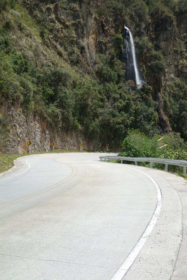
Once I had loaded the bike again, it was on to Popayán. Being above the tree line brought with it a headwind that carried some bite. However, after a few kilometers, I crested the highest point of the road, signalling that it was all downhill from there.
I have no doubt that many cyclists have dreamt about such a descent; sweeping corners that spit you out with an effortless speed, newly sealed roads, bridges over powerful whitewater also making its descent, and very little traffic to interrupt the flow. I should also mention that it was about 40km from top to bottom.
As I was nearing Popayán, I came into a merging Y-intersection at the same time as two mountain bikers (mountain e-bikers, but I will try not to hold that against them). Juan and Fabio were Popayán locals who were completing a 50km circuit from town. They pointed out their route which had taken in the backroads and fire trails of the hills that tower above Popayán. This had finished with a steep downhill descent through the forest coming out on the road where we met. There was little conversation between us, but I think the fact that they had battery assistance up the hills played on their minds, as they let me stick with them for the rest of the ride. They even chaperoned me to a hostel in the historical centre of town.

I stayed two nights in Popayán which, understandably, is touted as one of Colombia’s most elegant colonial settlements. As soon as I rolled into town I was struck by the single-storey, chalk-white houses that lined the streets. It is easy to see how the town has been dubbed La Ciudad Blanca (the White City). By the time I had found a cheap hostel and hung out my wet clothes from the previous day, the sun was beginning to drop over the horizon. I wandered into the centre of town to find something for dinner but was overcome by the way the light was bringing the streetscape to life. The centre of town was laid out in a perfect grid, the streets orientated to the major cardinal points. Consequently, as the sun set, the east-west street were illuminated, Turning the white facades of the buildings all the colours of a ripe peach, whilst the intersecting roads were relegated to the shadows. I sat on the curb beneath the large trees of the central plaza, spellbound by the long shadows being cast up the street. Even the pigeons appeared three-times their size in the twilight glow.

Despite the various sites to be taken in around the city, I made the conscious effort to spend my rest day, resting. Breakfast lasted three hours by which time restaurants were beginning to display signs for the cheap set lunches that are central to the lives of Colombians.
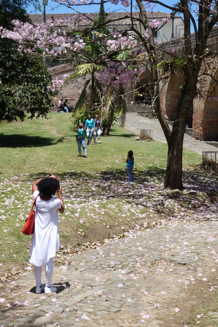
Sufficiently fed, I spent the afternoon in a slow amble. The central plaza made the perfect reference point thanks to the enormous palm trees and tropical conifers that towered above the town’s architecture. The walk lead me down to the the river that dissects the historical centre of town, where I found two bridges, oozing charisma and no doubt with plenty of stories to share. The smallest of the two, a single arch over the river, was constructed in 1713. Puente de la Custodia, as it is known, was built to allow priests to cross the river and deliver the holy orders to the sick within the poor northern suburbs. The second bridge, Puente del Humilladero, was built around 160 years later and stands along side its smaller predecessor. Painstakingly built from stone, this structure is 178m long and has a total of twelve arches. I took my time crossing each bridge, encapsulated by the final blossoms of the season, floating away from their branches with the slightest breath of wind.
As the sun began to fall towards the distant cordillera on my last night in Popayán, I joined a procession of locals to make somewhat of pilgrimage. Overlooking the city, El Morro de Tulcan provides the perfect vantage point for taking in the sunset. This hill, reached via a maze of well-worn dirt paths amongst the grass, is thought to be the site of a pre-Colombian pyramid. History aside, it is now the place to be if you are a photographer, into flying kites, a romantic, or a selfie-stick. It was also the perfect location to look at where I’d been, where I was, and where the road would take me next.

La Frontera
From Popayán, I will join the Panamericana (Carretera 25) to head south towards the border of Colombia and Ecuador. When I ask locals what the road is like, they make a waving action with their hand, like when you put your arm out of the car window and let the wind dictate its up and down motion. I assume this means hills.

Thanks for reading.